
Regional guide · Texas
Bulkheads & Seawalls on the Upper Texas Coast
Bulkheads around Galveston, Clear Lake, Kemah and League City: Galveston Bay's small tides, Hurricane Ike surge, Gulf beachfront rules and permits.
Last reviewed by the Bulkhead Walls Editorial Team
Overview
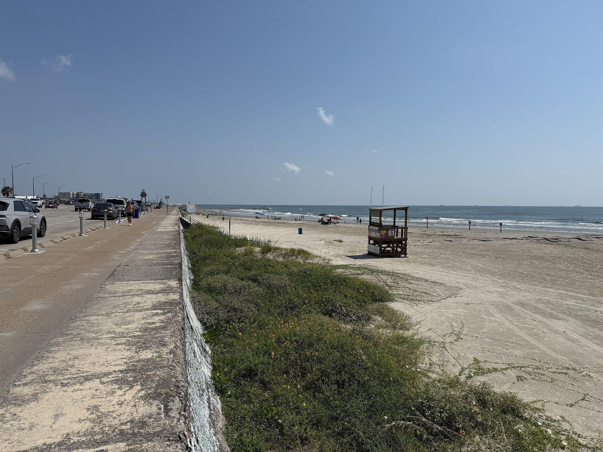
The upper Texas coast around Galveston Bay has small daily tides, about 1 foot on average, but Hurricane Ike in 2008 pushed an estimated 10 to 15 feet of surge onto Galveston Island and the west side of the bay. Bulkhead work commonly involves the Corps Galveston District, the Texas General Land Office and local permits.
- Communities covered
- Galveston, Clear Lake, Kemah, League City
- Waterbodies
- Galveston Bay, West Bay, Clear Lake, Dickinson Bayou, Offatts Bayou, Galveston Channel, Gulf of Mexico
- Water types
- saltwater, brackish, tidal
Key local considerations
- NOAA datums show a mean tide range of about 1.0 foot at Galveston Pier 21 and Eagle Point.
- Hurricane Ike (2008) produced estimated surge of 10 to 15 feet on Galveston Island and the west side of Galveston Bay.
- Galveston requires a Beachfront Construction Certificate/Dune Protection Permit for construction within 1,000 feet of mean high tide on the Gulf.
- Structures over state-owned submerged land may need Texas General Land Office authorization.
- Water levels during Ike began rising about a day before landfall, per the National Hurricane Center.
The upper Texas coast centers on Galveston Bay and the barrier island city of Galveston. Clear Lake opens to the bay between Kemah and Seabrook, with League City along its shore. This page covers Galveston Island and the western side of Galveston Bay, including Clear Lake, Kemah and League City.
The waterfront environment
Galveston Bay and its tributaries
Galveston Bay is broad and shallow, with West Bay extending behind Galveston Island. Clear Lake, Dickinson Bayou and other tributaries carry bay water inland into residential and marina areas. On Galveston Island, Offatts Bayou and the Galveston Channel provide sheltered bay-side frontage, while the Gulf side faces open beach. Wind can build waves across the open bay, so exposure differs greatly between an open bayfront lot and a canal lot a short distance inland.
Small tides
NOAA tidal datums show a mean tide range of about 1.0 foot at Galveston Pier 21 and at Eagle Point on the west side of the bay, about 1.2 feet at the Galveston Bay Entrance and about 1.1 feet at Morgans Point in the upper bay. With so little daily tide, the largest loads on a bulkhead usually come from storms and wind-driven water, along with heavy rain that saturates backfill. Weep holes and filter fabric still matter; see seawall drainage.
Storm history
Hurricane Ike made landfall near Galveston in September 2008. The National Hurricane Center's report describes the surge on this part of the coast:
- Storm surge on Galveston Island and the west side of Galveston Bay is estimated at 10 to 15 feet.
- The highest inundation, at least 10 feet, occurred on the bay side of Galveston Island and along the coast of mainland Galveston County.
- The NOS gauge at Eagle Point on the west side of the bay recorded a maximum surge of 11.48 feet; several other gauges failed.
- On the Bolivar Peninsula, ground teams found surge generally between 15 and 20 feet.
- Water levels began rising rapidly about 24 hours before landfall. Flooding cut off evacuation routes from areas such as the Bolivar Peninsula before strong winds arrived, and storm tides were already running near 8 feet in the vicinity of Galveston about 6 to 8 hours before landfall.
That last point matters for planning: bayfront walls can be under high water for many hours, not just at landfall. Prolonged high water followed by drawdown can wash out fill behind a wall and expose weaknesses at joints, tiebacks and the toe. See signs of bulkhead failure and tieback and anchor repair.
Permitting on the upper Texas coast
Bulkhead work here commonly involves federal, state and local review. Our Permit Navigator lists the agency pages we have verified for Texas.
Federal
The U.S. Army Corps of Engineers, Galveston District, reviews work in waters of the United States along the Texas coast. Federal actions in the coastal zone are also reviewed by the Texas General Land Office for consistency with the Texas Coastal Management Program.
Texas General Land Office
The GLO authorizes structures on state-owned submerged land. It describes residential piers as needing GLO authorization, often through Coastal Field Offices, and notes that single-family structures qualifying for Structure Registration have a one-time $25 application fee with no annual rent. For residential piers, the GLO says it administers the Corps permit alongside Structure Registration. Ask the GLO whether a bulkhead or associated fill affects state-owned submerged land.
City of Galveston beachfront rules
On the Gulf side, the City of Galveston's Coastal Resources Division requires a Beachfront Construction Certificate/Dune Protection Permit before construction within 1,000 feet of the mean high tide line of the Gulf of Mexico. The GLO certifies that local beach access and dune protection plans meet state minimums under the Open Beaches Act and Dune Protection Act. Gulf beachfront projects therefore follow a different path from bay-side bulkheads.
Other cities
League City, Kemah, Seabrook and other bay communities issue their own building permits. Contact the city or Galveston County for local requirements.
Planning a project here
- Identify the frontage: Gulf beach, open bay, sheltered bayou or canal. Each has different exposure and rules.
- Ask a licensed engineer how the design accounts for prolonged high water, not just peak surge.
- Check with the GLO and the Corps early if any work extends over or into the water.
- Read the bulkhead permit guide, steel vs. vinyl bulkheads and how to hire a marine contractor.
This page is educational. Agencies decide what a specific project requires.
Frequently asked questions
Who regulates bulkheads on Galveston Bay?
Commonly more than one agency. The U.S. Army Corps of Engineers, Galveston District, reviews work in waters of the United States, the Texas General Land Office authorizes structures on state-owned submerged land, and the city or county issues local permits.
Does Galveston have special rules near the Gulf beach?
Yes. The City of Galveston requires a Beachfront Construction Certificate/Dune Protection Permit before construction within 1,000 feet of the mean high tide line of the Gulf of Mexico.
How high did water reach during Hurricane Ike?
The National Hurricane Center estimated 10 to 15 feet of surge on Galveston Island and the west side of Galveston Bay, with at least 10 feet of inundation on the bay side of the island and along mainland Galveston County. The Eagle Point gauge recorded a maximum surge of 11.48 feet.
Sources
- 1Tropical Cyclone Report: Hurricane Ike (AL092008) — NOAA National Hurricane Center. Accessed November 3, 2026.
- 2Datums for 8771450, Galveston Pier 21, TX — NOAA Tides & Currents. Accessed November 3, 2026.
- 3Datums for 8771013, Eagle Point, Galveston Bay, TX — NOAA Tides & Currents. Accessed November 3, 2026.
- 4Datums for 8771341, Galveston Bay Entrance, North Jetty, TX — NOAA Tides & Currents. Accessed November 3, 2026.
- 5Datums for 8770613, Morgans Point, Barbours Cut, TX — NOAA Tides & Currents. Accessed November 3, 2026.
- 6Beach Front Construction — City of Galveston. Accessed November 3, 2026.
- 7Coastal Leasing and Easements — Texas General Land Office. Accessed November 3, 2026.
- 8Open Beaches — Texas General Land Office. Accessed November 3, 2026.
- 9Coastal Management Program — Texas General Land Office. Accessed November 3, 2026.
Educational guidance only. This information is general and is not a structural assessment, engineering advice, or a permitting determination. Conditions at every waterfront are different; consult a licensed marine contractor or professional engineer about your wall.