Regional guide · Florida
Bulkheads & Seawalls in Southeast Florida
Seawalls in Palm Beach, Fort Lauderdale and Miami: tidal flooding, local seawall elevation ordinances, Miami-Dade Class I permits and storm history.
Last reviewed by the Bulkhead Walls Editorial Team
Overview
Southeast Florida's canal and bay waterfronts face tidal flooding as well as hurricane surge, and several local governments now regulate seawall height and upkeep. Fort Lauderdale and Miami Beach set minimum seawall elevations, and Miami-Dade County requires a Class I permit for work in tidal waters, in addition to state and federal review.
- Communities covered
- Palm Beach, West Palm Beach, Fort Lauderdale, Miami, Miami Beach
- Waterbodies
- Lake Worth Lagoon, Atlantic Intracoastal Waterway, New River, Biscayne Bay, Atlantic Ocean, residential canal systems
- Water types
- saltwater, brackish, tidal
Key local considerations
- Fort Lauderdale's 2023 seawall ordinance update sets a minimum top elevation for seawalls and other tidal barriers.
- Miami Beach requires new seawalls to reach 5.7 feet NAVD, or 4 feet NAVD if designed to support a future 5.7 feet.
- Miami-Dade County requires a Class I permit for work in tidal waters or coastal wetlands, including within municipalities.
- Broward and Miami-Dade counties hold Environmental Resource Permitting delegation agreements with the state.
- Mean tide ranges are about 2 to 2.7 feet at NOAA stations from Palm Beach to Miami.
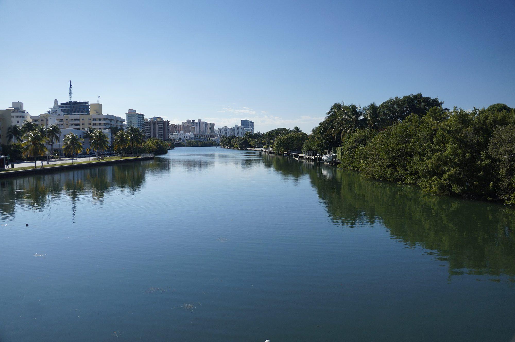
Southeast Florida's waterfront is a mix of Intracoastal Waterway frontage, finger canals, the Lake Worth Lagoon, the New River and Biscayne Bay. Much of it is low-lying and densely built. Here seawalls are increasingly treated as flood barriers as well as erosion control, and local governments have written that role into code. This page covers Palm Beach County south through Broward and Miami-Dade.
The waterfront environment
Canals, lagoons and the bay
Behind the Atlantic barrier islands, the Intracoastal Waterway connects the Lake Worth Lagoon in Palm Beach County with Broward's canal neighborhoods and Biscayne Bay. The City of Fort Lauderdale describes itself as having more than 300 miles of waterway coastline. The City of Miami Beach reports approximately 53 miles of seawalls, 92 percent of them on private property.
Tides and tidal flooding
NOAA tidal datums show a mean tide range of about 2.7 feet at the Port of Palm Beach, 2.5 feet at South Port Everglades and 2.0 feet at Virginia Key. The daily range is moderate, but because much of the land is low, high tides can approach or overtop low seawall caps. Fort Lauderdale's seawall rules respond directly to tidal water flowing over walls onto neighboring property and streets. When a cap is too low, raising it may be part of a seawall replacement or a cap repair; see bulkhead cap repair.
Storm history
Hurricane Irma in 2017 produced notable surge in the region. The National Hurricane Center reported maximum inundation of 4 to 6 feet above ground level in portions of Miami-Dade County, especially along Biscayne Bay, where a sensor at Matheson Hammock Park measured 5.6 feet above mean higher high water. Inundation of 2 to 4 feet occurred across coastal sections of northern Miami-Dade, Broward and Palm Beach counties. NHC also noted that saltwater inundation in downtown Miami was largely confined within a block or two of the bay.
Local seawall ordinances
Fort Lauderdale
The City of Fort Lauderdale updated its seawall ordinance, ULDR Section 47-19.3, on March 23, 2023, to set a minimum top elevation for public and private seawalls and other tidal barriers. The city lists three situations in which an owner must raise a seawall:
- When building a new seawall.
- When the seawall is in significant disrepair, meaning more than 50 percent of the structure is damaged.
- When the owner has been cited for tidal flow breaching the seawall and affecting a neighboring property or right of way.
Check the current ordinance for the required elevation and any transition provisions.
Miami Beach
The City of Miami Beach adopted a seawall ordinance in January 2021 that codified minimum elevations for new seawalls and added penalties for owners who fail to maintain private seawalls that cause flooding on adjacent properties and rights of way. It gives owners up to 730 days to bring failing seawalls into compliance. New seawalls must reach a minimum of 5.7 feet NAVD, or 4 feet NAVD if designed to support a future elevation of 5.7 feet NAVD. Seawalls must be upgraded if the property undergoes new construction or substantial improvements. The city noted that its ordinance was modeled after ordinances recently adopted by Broward County and Fort Lauderdale. Confirm current requirements with the city, since ordinances are amended over time.
Permitting in Southeast Florida
Miami-Dade County Class I permits
Miami-Dade County states that a Class I permit must be obtained before performing any work in, on, over or upon tidal waters or coastal wetlands of the county or of any municipality in it. The county lists construction or replacement of docks and seawalls among covered work. A December 2025 county presentation describes Ordinance 25-73, the "Seawall Ordinance," which set review timelines for Class I seawall and bulkhead applications. The City of Miami Beach notes that seawall replacement there requires approvals from the Corps of Engineers, the State of Florida, Miami-Dade County and the city.
Broward and Palm Beach counties
Broward County holds an Environmental Resource Permitting delegation agreement with the state, as does Miami-Dade. Property owners in Broward municipalities should expect city building review and may encounter county environmental review. In Palm Beach County, start with the city or county building department. Our Permit Navigator lists the agency pages we have verified.
State and federal review
Outside delegated programs, the Florida Department of Environmental Protection or a water management district handles Environmental Resource Permitting, and work on state-owned submerged lands may need proprietary authorization. Beachfront construction seaward of the Coastal Construction Control Line involves DEP's CCCL program. The U.S. Army Corps of Engineers, Jacksonville District, reviews work in waters of the United States.
Planning a project here
- Find out the current cap elevation in NAVD 88 and the local minimum before design.
- Ask whether the project counts as new construction, substantial repair or maintenance under the local ordinance.
- Expect county environmental review in Miami-Dade and possibly Broward, in addition to building permits.
- Use the bulkhead permit guide, planning a seawall replacement and how to hire a marine contractor.
This page is educational and does not determine requirements for any property. Local, state and federal agencies make those determinations.
Frequently asked questions
When does Fort Lauderdale require a seawall to be raised?
The city lists three situations: building a new seawall, a seawall in significant disrepair (more than 50 percent damaged), and a citation for tidal water breaching the seawall onto a neighboring property or right of way.
What permits does a Miami-area seawall replacement need?
The City of Miami Beach notes that seawall replacement there requires approvals from the U.S. Army Corps of Engineers, the State of Florida, Miami-Dade County and the city. Other municipalities in the county also fall under the county Class I permit.
How high is a new seawall required to be in Miami Beach?
Under the city's 2021 ordinance, new seawalls must be built to a minimum of 5.7 feet NAVD, or 4 feet NAVD if designed to support a future elevation of 5.7 feet NAVD. Confirm current requirements with the city.
Sources
- 1Climate Resiliency — City of Fort Lauderdale. Accessed November 3, 2026.
- 2Miami Beach Commission Adopts First Seawall Ordinance of its Kind (Jan. 13, 2021) — City of Miami Beach. Accessed November 3, 2026.
- 3Class I Environmental Permit — Miami-Dade County. Accessed November 3, 2026.
- 4Class I Coastal Electronic Permits and Reviews Webinar (December 1, 2025) — Miami-Dade County. Accessed November 3, 2026.
- 5ERP Local Program Delegation — Florida Department of Environmental Protection. Accessed November 3, 2026.
- 6Tropical Cyclone Report: Hurricane Irma (AL112017) — NOAA National Hurricane Center. Accessed November 3, 2026.
- 7Datums for 8722588, Port of Palm Beach, FL — NOAA Tides & Currents. Accessed November 3, 2026.
- 8Datums for 8722956, South Port Everglades, FL — NOAA Tides & Currents. Accessed November 3, 2026.
- 9Datums for 8723214, Virginia Key, FL — NOAA Tides & Currents. Accessed November 3, 2026.
- 10Coastal Construction Control Line Program — Florida Department of Environmental Protection. Accessed November 3, 2026.
Educational guidance only. This information is general and is not a structural assessment, engineering advice, or a permitting determination. Conditions at every waterfront are different; consult a licensed marine contractor or professional engineer about your wall.