
State guide
Bulkheads & Seawalls in Texas
How bulkhead and seawall work is commonly regulated on the Texas coast: the General Land Office, Gulf beach and dune rules, the Corps and local permits.
Last reviewed by the Bulkhead Walls Editorial Team
Overview
On the Texas coast, bulkhead projects are commonly reviewed by the U.S. Army Corps of Engineers, the Texas General Land Office, which authorizes structures on state-owned submerged land and oversees Gulf beach and dune rules, and the city or county. Bay and canal bulkheads follow a different path from Gulf beachfront work.
- Communities covered
- Galveston, Clear Lake, Kemah, League City, Corpus Christi, Port Aransas, Rockport
- Waterbodies
- Gulf of Mexico, Galveston Bay, Corpus Christi Bay, Laguna Madre, Aransas Bay, Gulf Intracoastal Waterway
- Water types
- saltwater, brackish, tidal
Key local considerations
- Daily tides are small along the Texas coast, about 0.4 to 1.3 feet at NOAA stations we reviewed.
- Structures on state-owned submerged land may need GLO authorization.
- Gulf beachfront construction is subject to the Open Beaches Act and local dune protection rules.
- The Corps of Engineers Galveston District reviews work in waters of the United States along the coast.
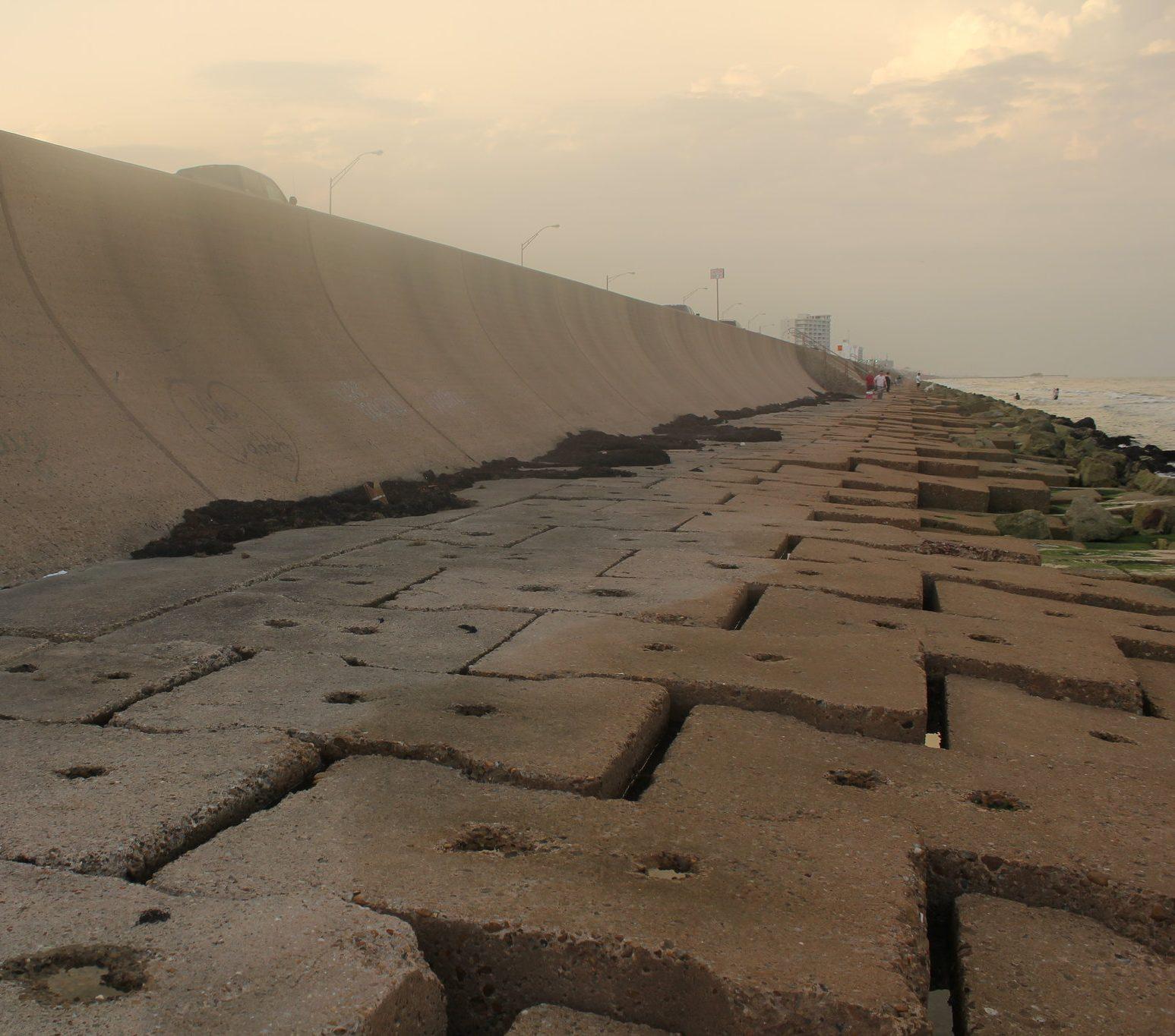
The Texas coast stretches along the Gulf of Mexico from the Sabine River to the Rio Grande, with large shallow bays and lagoons behind barrier islands. Walls on this coast range from private canal and bayfront bulkheads to public structures such as Corpus Christi's 1939 to 1941 bayfront seawall. This page summarizes the statewide picture. The regional pages cover the Upper Texas Coast around Galveston Bay and the Coastal Bend around Corpus Christi.
How bulkhead work is typically regulated
Texas splits shoreline review among federal, state and local agencies. Which apply depends on where the work is and whether it extends into the water or onto the beach.
| Agency | What it commonly covers |
|---|---|
| U.S. Army Corps of Engineers, Galveston District | Federal permits for work in waters of the United States along the Texas coast |
| Texas General Land Office, coastal leasing | Authorization for structures on state-owned submerged land, such as piers, through structure registration, easements or leases |
| Texas General Land Office, Coastal Management Program | Consistency review of federal actions in the Texas coastal zone |
| Texas General Land Office, Open Beaches | Public beach access and dune protection on Gulf beaches, including review of local plans |
| City or county | Building permits and, on the Gulf, beachfront construction certificates and dune protection permits |
Our Permit Navigator links to each verified page.
State-owned submerged land
The GLO states that residential structures over state-owned submerged land, typically piers, need GLO authorization, often handled by Coastal Field Offices. Single-family structures that qualify for Structure Registration have a one-time $25 application fee and no annual rent. For residential piers, the GLO administers the Corps permit alongside Structure Registration, which it says reduces the time and coordination needed. Commercial uses such as marinas, breakwaters and docks generally need an easement or lease.
Gulf beaches and dunes
The GLO describes public access to Gulf beaches as a constitutional right in Texas and enforces the Texas Open Beaches Act. Coastal cities and counties must adopt local rules protecting beach access and setting construction standards, through beach access plans and erosion response plans that the GLO reviews against the Open Beaches Act and Dune Protection Act. In Galveston, for example, construction within 1,000 feet of the mean high tide line of the Gulf requires a city Beachfront Construction Certificate/Dune Protection Permit. Anyone considering a wall on or near a Gulf beach should start with the local government and the GLO.
Conditions on the Texas coast
Astronomical tides are small. NOAA datums show a mean range of about 1.0 foot at Galveston Pier 21, 1.3 feet at Bob Hall Pier near Corpus Christi and about 0.4 feet at Rockport. Storms are the dominant loading event. The National Hurricane Center estimated 10 to 15 feet of surge on Galveston Island and the west side of Galveston Bay during Hurricane Ike in 2008, and up to 10 feet of inundation in the back bays north and east of Hurricane Harvey's 2017 landfalls near Rockport.
Where to go next
- Bulkhead permit guide
- Steel sheet piling and vinyl bulkheads
- Signs of bulkhead failure
- How to hire a marine contractor
This page is educational. The Corps, the GLO and local governments decide what a specific project requires.
Frequently asked questions
What does the Texas General Land Office regulate for waterfront owners?
The GLO authorizes residential and commercial structures on state-owned submerged land, such as piers, through structure registration, easements or leases. It also manages the Texas Coastal Management Program and enforces the Open Beaches Act.
Are Gulf beachfront walls treated differently from bay bulkheads in Texas?
Yes. Gulf beaches fall under the Open Beaches Act and local beach access, dune protection and erosion response plans. Galveston, for example, requires a Beachfront Construction Certificate/Dune Protection Permit within 1,000 feet of mean high tide.
Are tides a big factor for Texas bulkheads?
Astronomical tides are small, roughly a foot or less at many stations. Storm surge, wind-driven water levels and waves usually drive the largest loads.
Sources
- 1Coastal Leasing and Easements — Texas General Land Office. Accessed November 3, 2026.
- 2Coastal Management Program — Texas General Land Office. Accessed November 3, 2026.
- 3Open Beaches — Texas General Land Office. Accessed November 3, 2026.
- 4Beach Front Construction — City of Galveston. Accessed November 3, 2026.
- 5Datums for 8771450, Galveston Pier 21, TX — NOAA Tides & Currents. Accessed November 3, 2026.
- 6Datums for 8775870, Corpus Christi, Bob Hall Pier, TX — NOAA Tides & Currents. Accessed November 3, 2026.
- 7Datums for 8774770, Rockport, TX — NOAA Tides & Currents. Accessed November 3, 2026.
- 8Tropical Cyclone Report: Hurricane Ike (AL092008) — NOAA National Hurricane Center. Accessed November 3, 2026.
- 9More Than a Wall: The Story of the Corpus Christi Seawall — Corpus Christi Public Libraries. Accessed November 3, 2026.
- 10Tropical Cyclone Report: Hurricane Harvey (AL092017) — NOAA National Hurricane Center. Accessed November 3, 2026.
Educational guidance only. This information is general and is not a structural assessment, engineering advice, or a permitting determination. Conditions at every waterfront are different; consult a licensed marine contractor or professional engineer about your wall.